
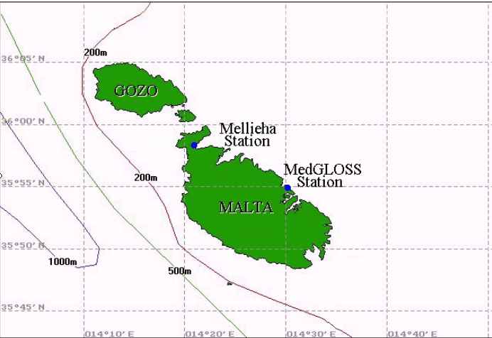
Location
of sea level stations maintained by the PO-Unit
 |
| |
| Mission | |
| Meteo-Marine Observations | |
| Numerical Modelling | |
| MedGLOSS Malta Station | |
| International Projects | |
| How To Find Us | |
| Contact Us |

|
Sea Level Measurements____
|
|
The station was equipped with a new ENDECO 600XLM probe in May 2000. The system is operated by solar energy and is used as a secondary station to the MedGLOSS station that operates at Portomaso. In addition to the data from the permanent stations, short term deployments have been also undertaken, both along the coast and in the open sea.This includes simultaneous recordings by an array of land-based barographs and a set of simultaneous bottom pressure recordings across the Malta Channel. |
On the merit of the position of the island within the Strait of Sicily, these data sets are particularly important for understanding the role of the strait in controlling the exchange between the two major basins of the Mediterranean Sea. With an internal Rossby radius of just a few tens of kilometres on the shelf areas, mesoscale phenomena in the Strait of Sicily are impossible to detect and follow unless a detailed observation set is available in both time and space. Under such circumstances, sea level measurements become of great relevance as an indicator of the general dynamics of the sea (Wunsch, 1972) especially when measured, as in the case of Malta, at a location away from the continental mainland.
Besides the importance of these data sets in relation to studies on global climate change and sea level rise, the use of this data is essential for studies on salt intrusion in the natural ground water aquifer, effect on the dispersion and flushing of pollution in the coastal areas, calculation of extreme sea levels in connection with the building of coastal structures, and others. Rises in sea level by only a few tens of centimetres can have serious consequences for many coastal areas; the most evident are coastal inundation and erosion.
|
Besides the importance
of these data sets in relation to studies on global climate
change and sea level rise, the use of this data is essential
for studies on salt intrusion in the natural ground water
aquifer, effect on the dispersion and flushing of pollution
in the coastal areas, calculation of extreme sea levels in
connection with the building of coastal structures, and others.
Rises in sea level by only a few tens of centimetres can have
serious consequences for many coastal areas; the most evident
are coastal inundation and erosion. |
|

An exhaustive and detailed analysis of the sea level data collected in the period June1993 - December1996 is given in DRAGO, 1999. This work gives a broad and updated study of sea level variations in Malta particularly with reference to long period waves.
Since 1988 the Malta Maritime Authority has also operated a mechanical sea level gauge for intermittent periods in the Grand Harbour. Originally the instrument was stationed at Pinto Wharf. Analysis of 13 months of data from May 1990 to May 1991 were used to obtain the tidal harmonic constants in the harbour (DRAGO, 1992). Measurements were interrupted in 1994 and resumed in 1996 at a position close to the mouth of French Creek. The instrument is currently positioned at Ras Hanzir which is at an inner location along the main channel of the Grand Harbour.
Historical Sea Level
Data____ 
A long historical data set of sea level chart records in the Grand Harbour are kept at the British Hydrographic Office and cover the period 1876-1926. The sea level gauge was held in the French Creek except for a period of five years starting from 1903 when the measurements were transferred to Ricasoli. Unfortunately no records exist after 1926.
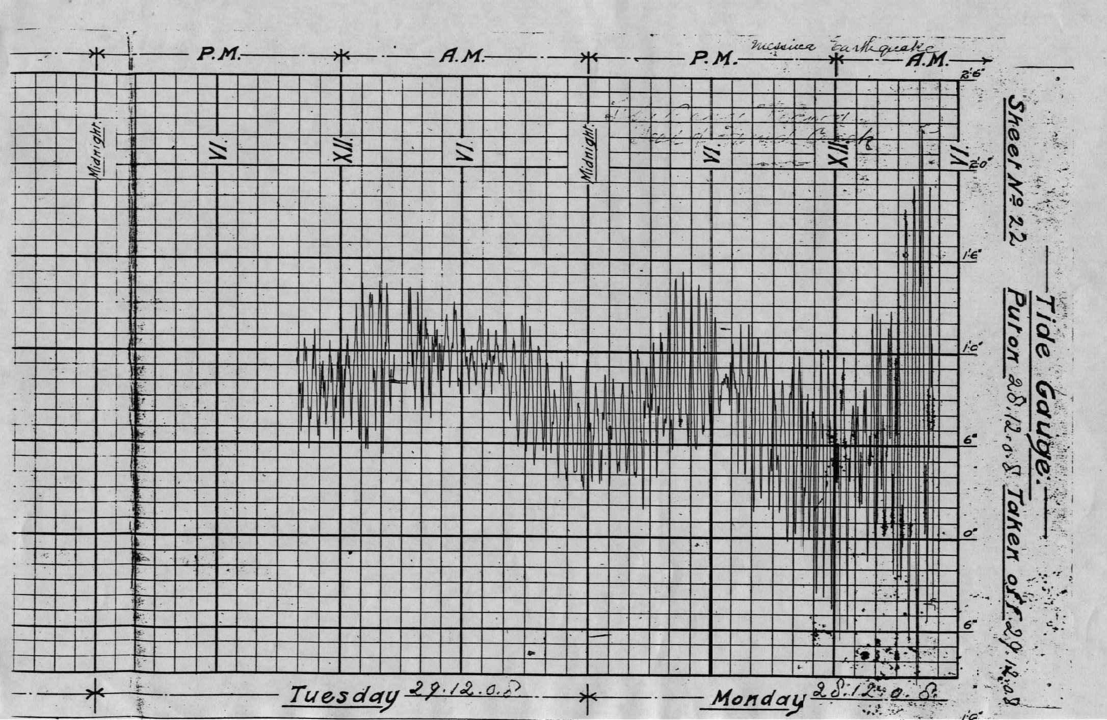 |
Tide
chart in the Grand Harbour taken in 1908, registering a tsunami. |
-
Click image to enlarge
|
Study of Seiche Oscillations____
A most remarkable feature in the sea level signals observed in Malta consists of a band of high frequency signals with periods ranging from several hours to as low as a few minutes. These non-tidal short period sea level fluctuations are an expression of a coastal seiche, known by local fishermen as the 'milghuba' . This phenomenon has now been observed to occur all along the northern coast of the Maltese archipelago and manifests itself with very short resonating periods of the order of 20 minutes in the adjacent coastal embayments. The phenomenology, generation and impact of the 'milghuba' on the coastal dynamics constitute the major focus of the study by DRAGO, 1999.
Analysis shows that weak seiching is present uninterrupted and appears as a background 'noise' on the tidal records. During random sporadic events the seiche oscillations can however become greatly enhanced. The maximum range measured in Mellieha Bay reached 1.1m. The seiche is often big enough to mask completely the small astronomical tide.These large-amplitude sea level oscillations are accompanied by remarkable currents that are triggered by the sloshing water masses. These currents are comparable in size to those generated in coastal areas characterised by tidal forcing.
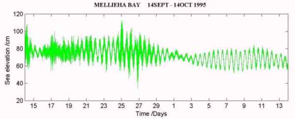 |
Time
series of sea level measurements in Mellieha Bay showing
seiching events
|
While these seiche induced currents can be an important means for the flushing of coastal inlets and harbours, they can on the other hand be dangerous to navigation.
Similar seiche oscillations have been reported in other parts of the world ocean, with the most recent studies being those conducted in Puerto Rico and the Philippines (Giese et al., 1982), in Nagasaki on the southern coast of Japan (Hibiya & Kajiura, 1982), at Capetown in South Africa (Shillington, 1984), at the Balearic Islands (Monserrat et al., 1991), and in the South Kuril Islands (Djumagaliev & Rabinovich, 1993). They are reported to cause severe damage to coastal areas, boats and port constructions. Due to their close relation with the behaviour of tsunami, research on seiches is considered to be important in disaster mitigation studies (Taku et al., 1992).
Reference to similar sea level variations (known as the 'Marrubbio') on the southern coast of Sicily is found in the Italian 'Portolano' for ship navigation. Their occurrence is reported to be most frequent in May or June in association to southeasterly winds, and their crest-to-trough amplitudes reach as high as 1.5m. Literature on the 'Marrubbio' is however very scarce and the only relevant publication is by Colucci & Michelato (1976). It is interesting to note that one of the first scientific studies on seiches by Sir George Airy (1878) refers precisely to the Grand Harbour in Malta. Since then the seiche phenomenon in Malta remained unstudied until the work conducted recently by the PO-Unit, which indeed constitutes the first study dealing with these high frequency sea level oscillations in the Central Mediterranean.
The large amplitude seiches
in the Maltese Islands are mainly of an atmospheric origin. The
simultaneous measurements of sea level and atmospheric pressure
reveal the presence of pressure fluctuations of the order of a few
millibars in coincidence with the occurrence of seiche events. These
pressure signals are believed to be the surface expression of atmospheric
wave disturbances that propagate in the lower troposphere as internal
gravity waves. Their interaction with the open sea surface triggers
the long period waves that subsequently force the seiches in the
coastal areas.
Meteorological Data
Collection____
Meteorological parameters are measured by Aanderaa sensors at a nearby automatic weather station in Ramla tal-Bir which is situated on the coastal strip overlooking the South Comino Channel. The sensors are positioned in an unobstructed location at a height of 20m from mean sea level.
The
data set consists of wind speed and direction, air pressure
and temperature, relative humidity and net atmospheric radiation
each measured at one or two minute intervals. The station
is in operation since April 1994. Meteorological data from
this station is missing in the period between mid-October
1994 and mid-March 1995 due to a sensor malfunction caused
by the stray effect of a nearby lightning stroke. With sufficiently
long time series of the relevant sea and atmospheric parameters
it will be possible to model the effect of the wind and atmospheric
pressure on the mean sea level, and hence permit a more precise
prediction of sea levels including the prediction of surges.
|
|

Physical Oceanographic
Surveys____
A number of physical oceanographic surveys have been carried out by the PO-Unit especially in the period 1992/4. The main area investigated includes a considerable stretch of the NW approaches to the Maltese Islands.The survey targeted to study the phenomenology of the sea currents and water column structure. The collected data are important to identify the physical processes involved in the response of coastal embayment to external forcing agents. The data are being used in specialised analysis involving tasks in numerical modelling as a simulation tool for the dynamics of the coastal water body. These studies have also enabled a suite of instruments to become available for future investigations.
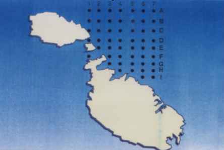 |
| Station
positions for the Oceanographic survey during 1993
|
Data collected from these surveys has been submitted to the project (MEDAR/MEDATLAS II) and consists of CTD profiles collected in the period 1992-1994 (Table 1). The full set consists of a total of 179 profiles collected during 5 surveys at different seasons with the intention of studying the water column structure and identifying the physical processes pertaining to this coastal stretch over a range of spatial and temporal scales. The survey in 1992 was the first ever physical oceanographic survey conducted by a CTD profiler in the Maltese coastal waters. The survey was conducted under the framework of the nationally funded Coastal Environment Research Project (CERP) with stations concentrated inside and in the vicinity of two coastal embayments – Mellieha Bay and St. Paul’s Bay. The subsequent surveys covered stations within an area of about 60 km2 on the NW coastal area of the Maltese Islands. The instrument used in the 1992/93 surveys is the FIS (Falmouth Scientific Inc) Integrated CTD equipped with a fast and a Pt temperature sensors. In the subsequent surveys an FSI mini-CTD was used. The data are processed by FSI software. The reformatting and quality control is done as part of this project.
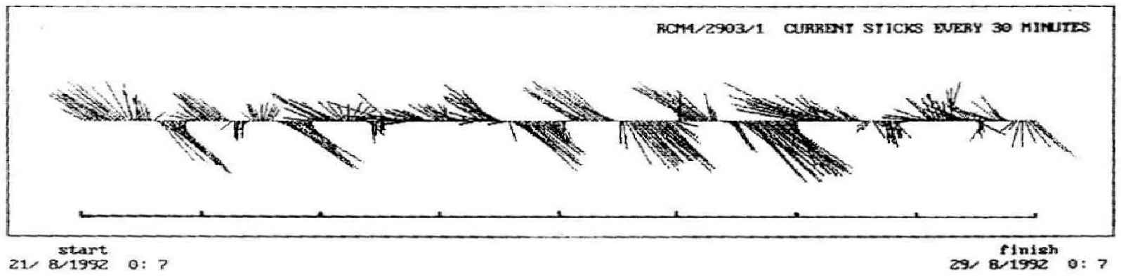
Subsurface Sea Currents____
Subsurface sea currents were measured for a period of one year at two stations in the NW coastal area of Malta. These measurements were aimed to study the phenomenology of sea currents on the shelf, particularly in connection with expression of coastally trapped waves in the form of strong diurnal signals. Measurements were also carried out for shorter periods at the Comino Channels, Marsalforn, outside the Grand Harbour and near Benghajsa Reef.
 |
|
Strong
diurnal signature in the deep subsurface currents outside
Mellieha Bay
|
|
-
Click image to enlarge
|